


Doddington Moor is 2 miles north-east of Wooler
A walk of about 4 miles up and over moors on different types of paths and tracks. The walk involves crossing several styles and fences, so it might not be suitable for very large dogs. You will pass the remains of a stone circle on route, although only one of the stones is standing now. There are no facilities on the walk itself, but Wooler is only 2 miles away, with cafes, pubs and shops.
Postcode for Satnav - NE71 6AU.
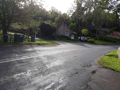
Take the B6525 which heads north-east from Wooler, signposted Berwick (A1), Doddington and Wooler Golf club. Doddington is 2.5 miles up this road. There is no easy parking on the main road through the village, but try the roads on the left in the village (heading towards Berwick), where there is parking by the village hall, and opposite a farm.
Click here to see a detailed routemap of the walk. This opens in a new tab.
Once you park your car, head into the centre of the village and take the roadway signposted for Wooler Golf club.
 A short distance up this road you will see a footpath signposted off on the right, that goes down to a style, then uphill. This first part of the walk is difficult as it is overgrown with gorse bushes and ferns, probably not a good idea to wear shorts and a T shirt.
 However, the gorse bushes just last for 100 yards or so, then you are out onto a grassy bank. The exact pathway is not too clear here, but you want to head uphill to the gateway that you see on the horizon. Pass through this gate, and follow the path alongside old hawthorn trees, then onto of an old field boundary ridge.

The path reaches a fence, where it is clearly marked as a right of way, but there is no gate or style. Climb over the fence, and continue along until you see a green seat on the hillside above you, where you can stop and take a rest as you've just climbed up a pretty steep hill and the view of the Cheviots is stunning.

The fence behind the seat is the golf course boundary. Follow the path thats runs by the fence up past the golf course, then right up to the hillfort which sits on the hilltop. You should easily be able to make out the stone foundation of a hut circle on your right.
 Follow this path over until you come to a track roadway, turn left on the track, then right just before the golf course and take the green trackway uphill to the trig point.
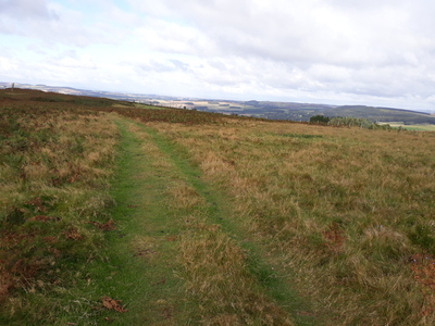 From here you can see views in every direction. Now follow the green trackway over the hill and down the other side, almost down to the fields, until you see another trackway crossing left - right. Turn left onto this trackway and follow it round the hillside. It deteriorates into a narrow path, but keep going and you will eventually see a standing stone close to the fields. Follow a very narrow path through the ferns to this stone, and you will see the remains of three or four more stones in the bracken and heather, all that remains of an old stone circle.

Now you could take that narrow path back through the bracken to the trackway, and follow it as it goes round the hill, but for a longer walk, take the narrow path beside the standing stone, and follow it up through the bracken and over a couple of fields. This path follows a fence line on your right. Near the end of the second field, as the path goes uphill again, you will see a gateway on the left with a yellow waymarker sign on it. Follow the path up to the gateway, and though up to another hillfort, called 'The Ringses'.
 The ramparts on this fort are very well preserved. Now continue to follow the footpath through the fort and along the top of the ridge, until it drops down to a wood. Here you will meet a stony farm track.
 Turn left and follow this track back to Doddington village.
Doddington Moor abounds with pre-historic remains. The walk passes through two iron age hill forts, and two more are close by. If you take a look at the accompanying map, you will see that there are several cup and ring marked rocks on the moor, and there is a cave with carvings to the south of the walk.
The stone circle is nothing like as evocative as the one at Duddo as only one stone is standing now. Apparently two stones were standing until 2004 when one fell over. Two of the stones in the bracken have the weathering marks that you expect to see on 4,000 year old stones, but the other two are shaped and tooled so they look more like gateposts than standing stones.
I associate stone circles with hilltops, where the circle can be seen for miles around, so I have a slight issue with the location of this circle. Duddo circle is on a hilltop with views all around, but Doddington is on a hillside with no views to the north and west. I guess all I can say is that to me, the position did not 'feel' right for a stone circle.
As you climb the hill and look down onto the village, you will see a prominent ruin down there. This is Doddington Bastle, not quite a Castle, but more than a fortified farmhouse. It is a relic of the troubled border wars from before the Union, but unfortunately you cannot get near it in the village.
none, just a nice walk.
Tap or Click on the Icon to see a picture of each walk. Click below the picture to visit the walk page.

Comments
No comments for this page yet.
Be the first to add a comment - tap the button above