


Maryport is a coastal town just north of Workington in Cumbria
A walk along a promenade with views over the Solway to Scotland, with the option to go inland near an old quarry. The promenade is fine for the disabled, but not the quarry diversion. There is a cafe at Maryport golf course at the end of the walk, and cafes, pubs and shops in Maryport town.
Postcode for Satnav - CA15 6EW
The A596 from Workington to Carlisle runs through the middle of Maryport. Turn uphill on Wood Street at the main crossroads with traffic lights by the church, then left at the top of the hill and take the next right, downhill to the harbour. Take the right turn at the bottom of the hill, just before the bridge over the river Ellen, and follow this road (King Street) past some houses, until you reach the promenade. As you reach the prom you will see a parking area on your left, with two more 2 car parks on the right a short distance further along.
If you cross over the bridge you will find more car parks, but they are all pay and display.
Click here to see a routemap of the walk. It will open in a new tab.
Head north up the promenade from the car park.
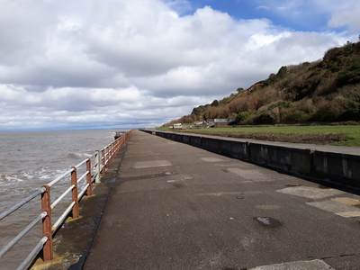 It was high tide when we were there, but when the sea is lower, you can get down to the shore and walk part way along the beach.
 Further up the promenade, you will see a blue hut on the right. You can turn right just before the hut,
 and divert through an old quarry, which is a bit more interesting for dogs.
 This narrow footpath climbs up and down,
 with views of the promenade down below.
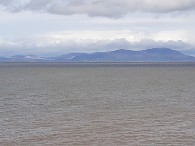
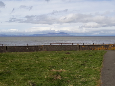
 In places the view opens up and you will see the Galloway hills in Scotland, over the Solway.
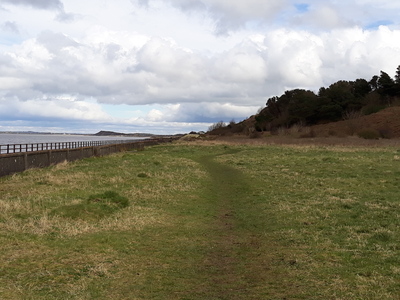
The path now runs back down to the prom,
 but it is still possible to walk along the grassy path.
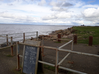
 The promenade ends at Maryport golf course, but you could walk over to the clubhouse for a drink if you wish.
Otherwise retrace your steps back along the prom. You will notice that seats are provided at regular intervals, and there is a plaque above each seat that features a Roman Emperor. There was a Roman fort at Maryport, built by the Emperor Hadrain.
 As you get nearer to the car park, you will see Maryport harbour in the distance.

When the Roman Emperor Hadrian planned his wall, he also wanted a string of forts built along the Solway coast to defend the country against sea attacks from Galloway. The southernmost fort was called Alauna, possibly after the local river, now called the Ellen. The remains of Aluana can still be found just inland from Maryport Promenade, and there is a Roman museum at the northern end of the town, which tells the story of the fort and the surrounding British town.
In the 16th century, a chap called Humphrey Senhouse decided to develop the small town of Ellenfoot into a major port, and renamed the town Maryport after his wife. The town became rich and prosperous, exporting coal from local mines, and iron from its own smelting works as well importing raw materials for the iron works at nearby Workington. Ships were built by the river Ellen, and the port supported a fishing fleet. It was also the head office of the Maryport and Carlisle Railway.
However all this changed towards the beginning of the 20th century. The local iron works and colliery closed and the Workington trade was lost when a new deepwater port was built at that town. The general strike in 1927 was the final straw, and the once prosperous port became a ghost town. In 1934 the Ministry of Labour produced a report which said that the rate of unemployment for men was over 60 per cent. Money was therefore released to employ some of these men to build the promenade which you see today.
 Cafe nearby
 Pub nearby (in Maryport)
 poo bins available
 toilets available (near the Harbour)
 wheelchair accessible
Tap or Click on the Icon to see a picture of each walk. Click below the picture to visit the walk page.
Comments
Ali - 3/8/2024 9.40
Be good to have details of parking especially if not familiar to the area.